













For decades, real estate marketing followed a predictable formula: a handful of interior photos, a short property description, and maybe a floor plan if the listing agent was feeling thorough. That formula worked when buyers had limited ways to evaluate a property before visiting in person. It does not work anymore. Today's buyers are visual-first, mobile-first, and impatient. They scroll through dozens of listings in minutes, and the properties that stop the scroll are the ones that show them something they cannot get anywhere else scale, context, and a genuine sense of place.
That shift is exactly why aerial imaging has moved from a "nice to have" to a competitive necessity in property marketing. Entrepreneurs, brokerages, and developers who have embraced this shift are not just producing prettier listings; they are fundamentally changing how quickly properties sell and how much trust buyers place in a listing before they ever schedule a showing.
The Problem With Traditional Property Marketing
Ground-level photography has an inherent limitation: it can only show what a camera can reach from eye level. A backyard pool, a property's proximity to a golf course, the layout of a gated community, or how a commercial site connects to nearby highways none of this comes across in a set of standard interior shots. Buyers are left guessing, and guessing leads to hesitation. Hesitation leads to longer days on market.
There is also a trust problem. Listings that rely on tightly cropped, flattering angles can create a mismatch between expectation and reality once a buyer actually visits. That mismatch erodes confidence, not just in a single listing but in the agent or brand behind it. In a market where reputation compounds across every transaction, that is a costly trade-off.
Marketing teams have responded by experimenting with virtual staging, 360-degree walkthroughs, and video tours. These tools help, but most of them are still confined to the interior or a single vantage point. What has been missing is context the ability to show a property the way a buyer would actually experience arriving at it, from above and around, in a single continuous visual story.
Why Aerial Perspective Changes Buyer Behavior
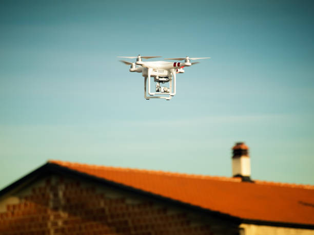
This is where drone-based visual content earns its place in a serious marketing strategy. An aerial shot does something a ground photo cannot: it establishes scale and orientation instantly. A single wide aerial pass can communicate lot size, landscaping, roofline condition, neighboring properties, and access roads in seconds information that would otherwise take paragraphs of text or multiple site visits to convey.
Data from listing platforms has consistently shown that properties marketed with aerial photography and video attract more views and generate faster engagement than listings using only ground-level images. For agents and developers running paid campaigns, that translates directly into a lower cost per qualified lead, because the content itself is doing more of the persuasion work before a prospect ever picks up the phone.
This is also why more marketing-savvy real estate businesses have started working with specialist teams covering inspection, mapping, aerial imaging, and other industry-specific drone applications, rather than treating aerial content as an afterthought handled by whoever on staff happens to own a drone. Professional real estate drone marketing services bring FAA-compliant flight operations, purpose-built flight paths, and post-production polish that a hobbyist pass over a property simply cannot replicate. The difference shows up in the final asset: consistent lighting, stable footage, and framing that is planned around the listing's strongest selling points rather than left to chance.
What Professional Aerial Real Estate Content Actually Includes
It helps to understand what separates a quick drone snapshot from a marketing-grade aerial package, because the gap is larger than most first-time buyers of these services expect.
A well-executed shoot typically opens with establishing shots that orient the viewer where the property sits relative to its street, its neighborhood, and any notable landmarks or amenities nearby. From there, the flight path narrows into feature shots: pools, outdoor entertaining areas, garages, outbuildings, and landscaping that ground-level photography cannot capture in a single frame. For larger residential or commercial parcels, orbit shots around the structure give buyers a 360-degree understanding of the building's massing and roofline, something that matters enormously for architecture-forward listings and commercial buyers evaluating a site for redevelopment.
Timing matters just as much as flight technique. Golden-hour and twilight aerial shoots, where the sky still holds color while interior and exterior lights are on, consistently produce the most emotionally engaging marketing assets in the industry. These shots are difficult to execute well because they require precise scheduling around sunset and tight coordination between the pilot and the property team to have lighting ready at the right moment, but they are also the images that get shared, saved, and remembered by prospective buyers scrolling through a crowded market.
Beyond static imagery, cinematic video flythrough have become a standard deliverable for higher-end listings. A single continuous flight that moves from a wide establishing shot, down toward the entrance and into a smooth transition that can be edited alongside interior walkthrough footage gives buyers something close to an in-person tour before they ever set foot on the property. For teams that want a deeper look at how this entire workflow comes together from pre-flight planning through final video delivery this breakdown of aerial imaging for real estate marketing walks through the process end to end, including how FAA airspace rules and property-specific flight planning factor into a shoot.
The Business Case: Faster Sales, Stronger Brand Positioning
None of this matters to a business owner unless it moves the needle commercially, and the evidence here is fairly consistent across the industry. Listings marketed with high-quality aerial content tend to spend fewer days on market, largely because they pre-qualify interest more effectively. A buyer who has already seen the property's layout, surroundings, and scale from an aerial video is a warmer lead by the time they reach out they are not starting from zero.
There is also a brand-positioning benefit that gets less attention than the direct conversion numbers. A brokerage, developer, or property management firm that consistently produces polished aerial content signals a level of professionalism and investment that separates it from competitors still relying on smartphone photos. In a fragmented industry where trust and perceived competence heavily influence which agent or firm a seller chooses to list with, that visual signal does real work in business development conversations, long before a formal pitch ever happens.
For commercial real estate specifically, aerial content plays an even larger role. Site selection decisions for retail, industrial, and logistics properties depend heavily on understanding traffic flow, adjacent infrastructure, and parcel boundaries all things that aerial imagery communicates far more efficiently than a survey document or a static site plan. Institutional buyers and investors evaluating multiple properties across a region often make first-pass decisions based on aerial and mapping content alone, before a site visit is even scheduled.
Where This Is Heading: Data-Rich Marketing, Not Just Pretty Pictures
The next phase of this trend is already visible in how leading firms are using drone-captured data. Aerial imaging is increasingly being paired with mapping outputs like orthomosaics and 3D models, which let a marketing team generate not just a flythrough video but an interactive model a prospective buyer can explore on their own schedule. For large residential developments and commercial parcels, this kind of interactive aerial model is becoming a differentiator in competitive bids and institutional sales processes, where decision-makers want to explore a site remotely before committing travel time to an in-person visit.
There is also a growing overlap between real estate marketing and other industry applications of drone data construction progress documentation for developments still being built, environmental and site-condition context for buyers doing diligence, and even energy-efficiency signals like roof condition that increasingly matter to sustainability-conscious buyers and ESG-focused institutional investors. Marketing teams that understand this broader toolkit are positioned to offer buyers more than a pretty video; they can offer a genuinely more informed decision-making process, which is ultimately what builds long-term trust in a brand.
For entrepreneurs and marketing leaders evaluating where to invest limited content budgets, the calculus is becoming straightforward. Ground-level photography still has its place for interior detail, but it is no longer sufficient on its own to compete for buyer attention. Aerial content has moved from differentiator to baseline expectation in markets where buyers have choices, and the firms that treat it as core infrastructure not an occasional add-on are the ones building durable competitive advantage.
Building Aerial Content Into a Repeatable Marketing System
The firms getting the most value out of aerial marketing are not treating each shoot as a one-off project. They are building it into a repeatable system: a standard shot list for every new listing, a pre-approved flight and lighting checklist for twilight sessions, and a content pipeline that turns raw aerial footage into photos, short-form video for social platforms, and longer flythroughs for the listing page, all from a single flight. That kind of standardization keeps production costs predictable while making sure every listing not just the flagship properties benefits from consistent, professional aerial content.
It also pays to think about aerial content as reusable across channels rather than a single-use asset for one listing page. The same flight that produces a hero video for a property listing can also generate still frames for paid social campaigns, b-roll for a brokerage's brand reel, and neighborhood-level establishing shots that get reused across an entire development's marketing over months or years. Viewed that way, the cost of a professional aerial shoot amortizes quickly across dozens of downstream marketing uses, which is a big part of why forward-looking firms have stopped treating it as a discretionary expense and started budgeting for it the same way they budget for photography or copywriting.
Frequently Asked Questions
Does aerial real estate marketing require special licensing or permits?
In the United States, commercial drone operations for real estate marketing require the operator to hold a Part 107 Remote Pilot Certificate from the FAA, along with compliance with local airspace restrictions. Reputable aerial imaging providers handle this licensing and airspace clearance as part of their standard workflow, so property teams do not need to manage compliance themselves.
How long does a typical aerial real estate shoot take?
Most residential aerial packages can be completed in under an hour on-site, though twilight shoots require additional coordination around sunset timing. Larger commercial properties or shoots that combine photography, video, and mapping deliverables typically take longer and are scheduled around weather and lighting conditions to ensure usable footage.
What is the difference between aerial photography and aerial videography for listings?
Aerial photography produces still images used primarily for listing photos and print materials, while aerial videography captures continuous flythrough footage that is edited into marketing videos, social media content, and virtual tour sequences. Most professional packages include both, since they serve different points in a buyer's research journey.
Can aerial imaging be used for commercial and industrial properties, not just homes? Yes.
Commercial and industrial properties often benefit even more from aerial content because buyers and investors need to understand site access, adjacent infrastructure, parking capacity, and parcel boundaries details that are difficult to convey through interior photography alone.
How does weather affect the scheduling of a drone real estate shoot?
Wind speed, precipitation, and cloud cover all affect both flight safety and image quality. Providers typically monitor forecasts closely and reschedule shoots when conditions would compromise stability or lighting, which is why booking with some flexibility around the target date tends to produce better results.





Add Comment